Welcome to Julsundmarka

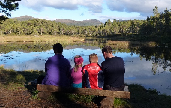
Welcome to exceptional experiences in the forest, fields and mountains. Tread with care, and take part in caring for this beautiful nature. Please take your trash home with you!
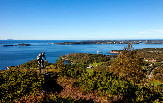
Julsundet is blessed with wonderful nature. Paths in all directions make this area ideal for hiking. The landscape is open with an expansive view of the village, the sea, islands, islets and skerries. Both children and adults can take memorable walks both in the forest and above the timberline. And if you prefer more challenging hikes, there are many to be enjoyed. Ramnfloget offers challenges for mountain climbers. The area borders with the municipalities of Molde and Fræna. Many excellent hiking trails cross municipal borders.
Map of tour destinations
Explanations of tour destinations on the map
The various destinations are described in the article below:

Hundetjønna
In the past water driven mills and threshers were common. The source of water in this area was Hundetjønna, with the river Tronselva that ran to Jendemsosen. The current path going from Hundetjønna to 1 on the map was originally set up as a transfer watercourse to Lauvåsen and Hollingen. From there the water ran partially in a natural valley and partially in a constructed trench up to the stone fence/infield 2. Every autumn a ditch was dug running from here, over the cultivated fields and onward to the waterwheel 3, that belonged to Lauvåsen. After the threshing was finished the ditch was filled in, so that a crop could be harvested the following summer.
From 3 the water ran in open, natural and partially constructed ditches by way of 4 which was the waterwheel for Hollingen, 5 and 6 that were the waterwheels for Haugen and Setra and then onward out to sea. This was in use for approx. 25-30 years from about 1890. After a while a conflict arose about the passage of water so it was closed in approx. 1920. There are not very many visible remains from the watercourse. But what is left behind, and what is told about it, shows that people in the past had a tremendous ability to make use of the limited resources they had at their disposal.
The water running through the watercourse from Hundetjønna to the sea was utilized many times and was in this way put to good use. By the river from Hundetjønna and down to Åsdalen there are remains after a millhouse and waterwheel 8. There was also a power transformer 9 for running the threshing machine on the northern farm at Lauvåsen. Farther down the river, north of Torhaugmyra, there was also such a mechanism 10 for use on the farm.
Lauvåsen
The name is believed to derive from Laufass, a hill densely covered by a deciduous forest. The first use of the name Lauvåsen in written sources dates from 1610, so it is not an old farm. The farm previously belonged to the Municipality of Fræna. The building was first located at area 13. Once, during a winter storm in the 1800’s, the building blew down. They had to move to a place with less harsh weather, and they relocated to the area where the farms are now.
Cotters’ Farms
Several cotters’ farms have been registered at Lauvåsen, such as Ane Marta-plassen 14, and Gjertinaplassen 15. In addition, there was a residence 16 called Andrinastykket and one at 17 called Hjorthola. At Bergegjerdet there were two cotters’ farms; they were joined as one – Bergegjerdet 18. At Mevoll there was also a cotter’s farm, Smedbøen 28, located by Vollelva River near the telephone station where homes are now being constructed. The name Smedbøen originated from the blacksmith who lived there, Smed-Ola.
The Stone Fence
In the area we also find other cultural artefacts, such as an almost continuous stone fence from Fanghol to Lauvåsen. The stone fence separated the infield and outfield areas, and had gates and shelter that people and animals could use. Within the stone fence there were several summer barns for use when animals were set out to graze. Two of them are still standing 7.
Hydroelectric Energy in Vollelva River
The great dam at Vollelva 11 was built in the 1940’s in order to obtain hydroelectric energy for the Hollingsæter Woodworks Factory. The power plant itself was located down by the road 12. Water from the lake was transported in wooden pipes made at the woodwork factory, downward and along the southern side of the Vollelva. In order to transport materials up the mountain, an aerial cableway was made from the factory up to Gammelsetra. The power station had a capacity of 25 kW DC, providing light and electricity for the factory and the nearest houses. The remains of the conduits carrying water to the hydroelectric plant are visible along the Vollelva.
The Mill
Down by the sea in Vollelva there was a mill; there are no visible remains from this. In Eidskremelva there was also a mill; it was in use during the last war, 1940-1945. Here on the farm there also was a sawmill. No trace of the mill remains.
Summer Dairies
20 Gammelsetra
The name indicates that there had at one time been a summer dairy here, but there is no information about this.
21 Fangholsetra
In 1941 Bernhard Fanghol built a barn. A cabin was built in 1942. The farms of Fanghol and Hollen shared a barn until 1947, when Magnus Hollen built his own barn. In 1959 operation of the summer dairy ceased. The cabin is still standing; the barn is gone, only the stone foundation remains.
22 Pressetra (Prestsetra)
There are still visible remains from the Priest’s summer dairy. The top stone step to the summer dairy cabin is easily visible. The summer dairy belonged to the Priest’s farm on Aukra. Legend would have it that one autumn they shipwrecked on the way home over the fjord with both people and animals. After that the summer dairy was no longer used. This legend is not confirmed.
23 Eidskremsetra
The summer dairy belonged to the three farms at Eidskrem. We don’t know when it was built, but according to Hans Eidskrem it was in use up until the end of the 1800’s. We can now see the remains of the foundation of the buildings, and the stone fence around the summer dairy embankment. Just up from the slope, by the path leading upwards, there are remains from the stone fence that served to keep the animals from going down to the village. 24 Gausetsetra This was the Gauset summer dairy, located at the entrance to Gausetdalen Valley. The remains of the walls are visible. The summer dairy was in use up until the beginning of the 1900’s.
All the summer dairies in Julsundet are located on the mountain. The way up is steep and heavy. They usually went up to the dairies during the evening, milked and cared for the animals, and spent the night in the summer dairy cabin. The next morning, after milking and caring for the animals, they took the milk with them and walked home again.
Remnants from the Ice Age
25 Eidskremsteinen / or the Eidskrem Stone
26 Kvilarsteinen / or the Kvilar Stone
This is a block of stone that was moved along by glaciers and left behind after the last ice age. They were moved by the ice over great distances and have smooth and round edges after being transported by the ice.
Burial Mounds
Among the visible burial mounds there is a large one in Kobbevika. On Langneset and Fangholneset there are burial mounds. In Hollingsbukta there are remains from burial mounds, but they are not very visible.
Yew
27: At the northeast end of Kryssvatnet Lake are the world’s northern most known and naturally growing yew trees. They are approx. 2-3 meters high. One finds also yew in Mordalslia, that have the shape of a tree and approx. 6-7 meters high.